Zimbabwe has, over the years, grown as a tourist hotspot for many people around the world. Endowed with natural beauty in its flora and fauna, as well as, its historical places and monuments, the country has made efforts to market its beauty to the outside world.
Ranked among the most visited African destinations, most people would love to travel to Zimbabwe to have a feel of its key sites and attractions, but are probably unable to do so due to lack of resources and time.
Thanks to a visual
The 37-year-old Zimbabwean has uploaded a majority of the country’s historical monuments on Google Street View for anyone across the world to have a true-life experience of the country’s important areas and landmarks.
Having left Zimbabwe to the United States to study journalism and documentary film-making at the University of California, Berkeley, Kanhema returned to his home country, and within a space of two weeks, shot the sights and sounds of the lovely sites in Zimbabwe.
According to a report by CNET, areas he covered include a virtual tour of Victoria Falls, the Great Zimbabwe monument, the Eastern Highlands, the central business districts in the country’s capital, Harare, and various malls.
He has also uploaded over 500 miles of coverage, including Street View images uploaded during October and November, the report added.
Kanhema’s mission was tough, and two weeks would not have been enough to cover all these major areas but with determination and hard work, he was able to pull through.

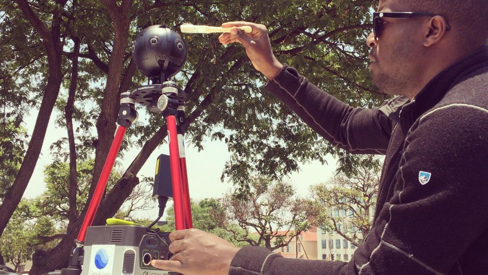
The interesting development is that he personally funded all the travel and production costs related to the project while Google and Insta360 provided the Insta360 Pro 2 camera through a camera loan program.
Now a product manager in San Francisco, building news applications and other tools for newsrooms, Kanhema said his love for visual storytelling developed in 2015 while experimenting with WebVR and WebGL frameworks through his work with journalists.
He soon started shooting 360 videos and photography and became interested in testing different camera platforms.
“In 2016, I got involved with Google’s user-generated content initiative, the Street View Camera Loan Program, which allows photographers to borrow a Street View ready camera and take it somewhere interesting. I then pitched two UNESCO World Heritage Sites, Victoria Falls in Zimbabwe and Stone Town in Zanzibar as ideal pilots for expanding Street View to new markets in southern Africa, a region that is still underrepresented and mostly missing from Street View,” he told CNET in an interview.
Spending about $5,000 in hotels, flights, a car rental and gas expenses, Kanhema, within ten days, drove about 8 hours a day, capturing all the major places of interest before processing and publishing them.
Although he had challenges of redos on days that involved a lot of movement, his most favourite part of the project was the mapping of the Zambezi River on a speed boat, he said. Overall, the Zimbabwe Street View project was “like rediscovering the country all over again.”
“It was quite nostalgic walking down the street on which I grew up on and quite emotional seeing how much has changed over the years. I’m glad to be able to capture a snapshot that will allow us to look back and see where the cities go from here. I get emails from Zimbabweans abroad who want to show their kids the streets they grew up on on Street View and I realize that there are not many ways to preserve those memories and the visual ethnography of a city,” he told CNET.
The next project for the visual storyteller is to map Stone Town in Zanzibar and other towns and sites on the Island.
Following improvements in technological innovations, virtual tours have become very common as one can travel to destinations all over the world without ever having to leave their homes.
People are basically turning on their smartphones and other devices instead of booking travels and making actual trips. Analysts say that when VR tours are done properly, people get a preview and understanding of what they would have to experience if they visited physically


